anden.at
Discover the Andes


Arequipa
by Martin Mergili


After having left the city of Cusco, Pachacutec has crossed the extensive Altiplano and finally descended to the valley of the Río Chili. From Incan times, he remembers that this was a rural area, strategically fairly important with numerous rather small villages. So he is very surprised to see a large and prospering city. He learns from the inhabitants that Arequipa is the second largest city of Peru and, at the same time, the most important urban centre in the southern part of the country. The city has a population of more than one million. In the historic centre, many important features of colonial cities are well preserved, so that it has been declared a UNESCO World Heritage Site. Arequipa is located at an elevation of approx. 2300 m asl. at the base of the stratovolcanoes Misti and Chachani and is well known for its sunny weather. But why is this this place also known as La ciudad blanca, the white city? Pachacutec stays some time here to explore these questions, before continuing his journey along the old Incan road - replaced by a modern highway - to a place which is now on the territory of the national state of Chile: the Pucará de Quitor.
By clicking on the warrior symbol you can obtain more information on the road network of the Inca.

The Plaza de Armas of Arequipa
You can look around by dragging the scene with the left or right mouse button.
This image shows the main square of Arequipa, an important element of every Spanish colonial city. The quare is surrounded by the cathedral with its extraordinarily wide front on one side, and by two-storey arcades on three sides. Nowadays it is an important commercial place, but also serves as a social meeting point.
You can have a look at the main squares of other former colonial cities in the contributions on Lima, Cusco, Salta, and Santiago de Chile. All these squares have their individual features, but in principle they follow quite similar schemes.
Photo: Martin Mergili

Arequipa: La ciudad blanca
Arequipa is known as the white city, La ciudad blanca. Among other reasons, this name is related to the fact that many buildings in the colonial centre are made of a white-coloured rock locally known as sillar.
Try to find answers to the following questions:
- How does this type of rock form, and what are its main characteristics?
- Why is it used as building stone especially in Arequipa rather than somewhere else?

Sillar forms by the consolidation of rhyolithic volcanic deposits such as tuff or ignimbrite.
This type of rock can be found around stratovolcanoes in the southern part of Peru. Therefore - and because of its good workability - it was preferred as building stone in this area. The video shows the evenly shaped Misti volcano directly outside Arequipa. The sillar used here, however, is mainly related to the Chachani volcano, which is also nearby.
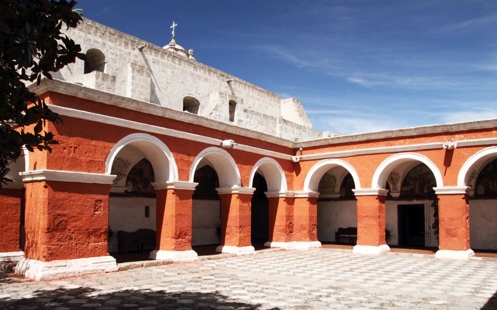
A stroll through the Monastery of Santa Catalina


This monastery in the centre of Arequipa was constructed in the mid 16th century in the Moorish style. It hosted Dominican nuns, which lived here in almost complete isolation from the world outside. The monastery was opened to the public as late as in 1970.
Explore the monastery by clicking on one of the arrows or in the image.
Could you imagine to live in this type of monastery? What would you like, what would you dislike? Write a short story about an average day in the monastery.