anden.at

Discover the Andes

Excursion guide Movies Photos Presentations

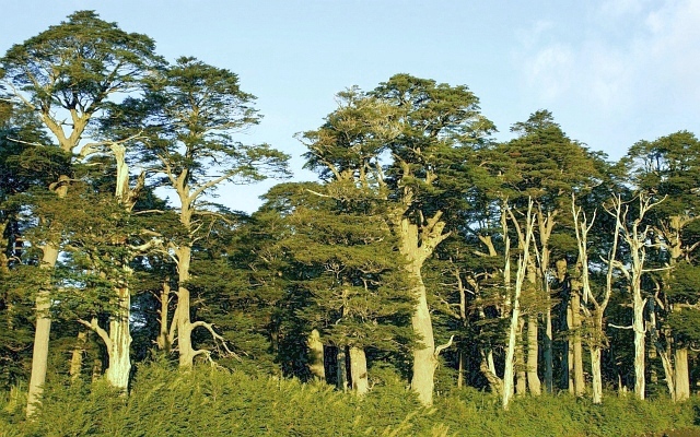
Land of volcanoes and araucarias

by Martin Mergili

Map

Strongly generalized and distorted sketch. Araucaria araucana only occurs in the northern, Fitzroya cupressoides only in the southern portion of the area shown in the profile.

General information

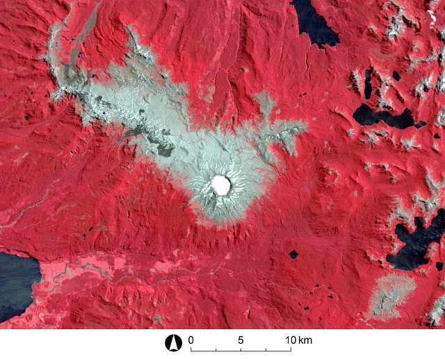
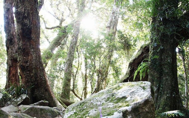
The Andes between approx. 600 km and 1000 km south of Santiago de Chile are among the most active volcanic zones worldwide. Stratovolcanoes such as the Llaima, the Villarrica, the Puyehue, or the Calbuco were the scenes of various explosive eruptions in the early 21st Century. But this area is also highly remarkable from an ecological point of view: two ancient species of conifers, with close relatives reaching far back into the geological history, can be found in the forests of the Little South as well as several species of southern beech and further plants belonging to a very special flora.

Click on the red symbols to learn more about the individual points of interest.

Exercise

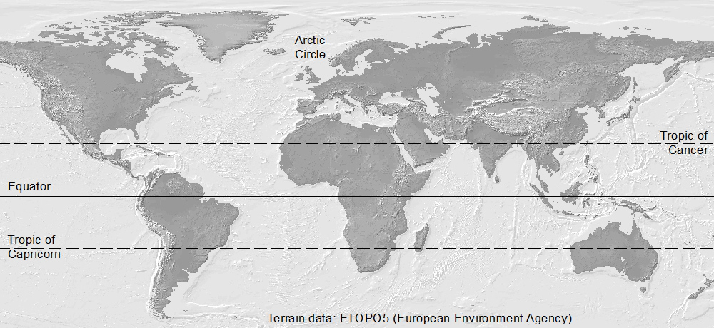
From which direction does the wind blow here? Click into the profile graph to learn about the answer. Compare also the contribution on the climate and vegetation of the Eastern Cordillera, considering an area almost 2000 km farther north.

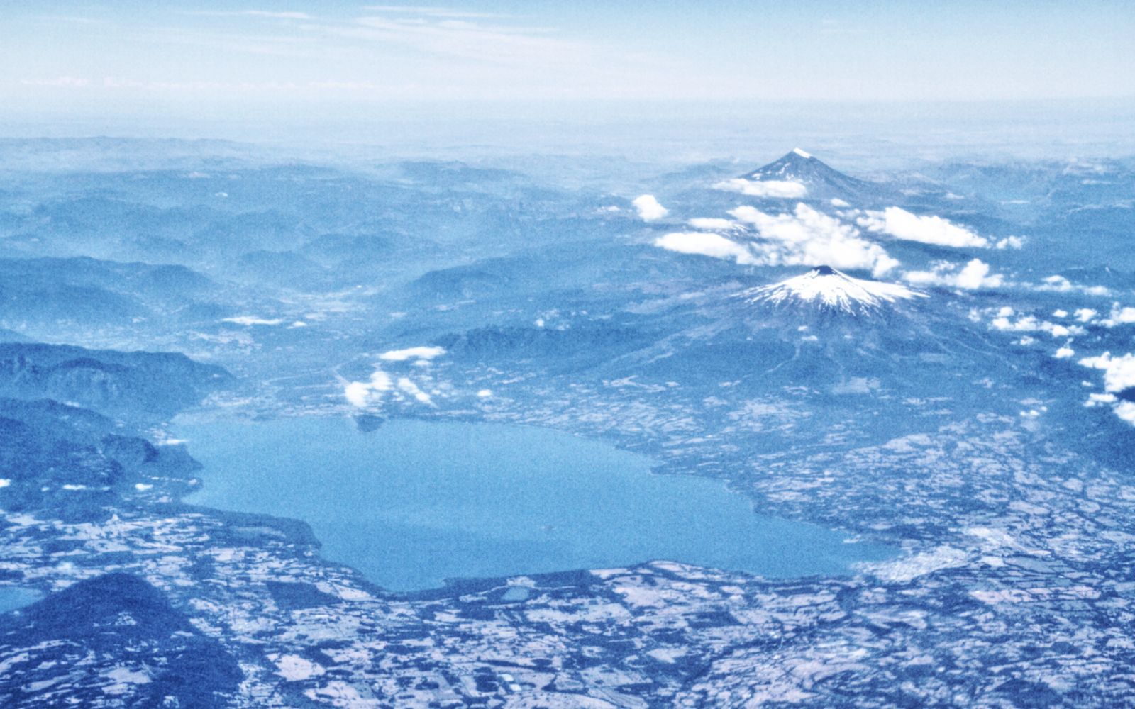
The Little South from the air

1 of 4

Click on the arrows or into the photograph to view the lakes and volcanoes from different perspectives.

These aerial views show the characteristic landscape at the western rim of the Andes approx. 700 km south of Santiago de Chile: whereas the numerous large lakes - filling basins scoured by the Pleistocenic glaciers - are bordered by farmland, the stratovolcanoes such as Lanín and Villarrica rise high above the forested hills.

All the photos were taken during a regular flight from Puerto Montt to Santiago de Chile on 28 February 2018.

The volcanoes Osorno and Llaima

Click on the arrow to start the movie.

This movie shows selected impressions from the stratovolcanoes Osorno and Llaima. You can learn more details about these two volcanoes in the contributions on the Conguillío National Park and on the volcanoes Osorno and Calbuco. The volcanoes of the Little South do not always present themselves as peaceful as in this movie. The following exercise illustrates this in a dramatic way.

Movie: Peter Mathis

Puyehue-Cordón Caulle: what happens here?

img
18 February 2011
img

Travel in time by clicking on the arrows or into the satellite scene.

This series of satellite scenes shows the mountain range Puyehue-Cordón Caulle and it surroundings at three different points in time.

First, describe what you can see in the individual images. In a second step, try to interpret your observations. Consider that you are working with infrared false colour scenes: this means that areas covered by dense vegetation (in this case, southern beech forests) appear in red colour. Try to answer the following questions:

  1. What happens here?
  2. What could be the consequences for the people living in the surrounding areas?
  3. Do you also expect global-scale consequences?
img

Image source: Landsat | Band combination 4-3-2 of Landsat 5 (2011) and band combination 5-4-3 of Landsat 8 (2013)

Show solution

The first scene shows a densely forested landscape with a vegetation-free area in the centre, possibly representing the upper part of a mountain range. The circular depression in the centre could even indicate a volcano - if it would be active, this could explain the vegetation-free area in its surroundings. However, there is obviously snow or ice in the crater in summer, so that there was no eruption in the near past.

The second scene was recorded in late autumn: the vegetation is less dense - deciduous trees might dominate the forest here - and there is snow at higher elevation. Southeast of the volcano, there seems to be very little vegetation. The cloud starting north of the main crater and continuing in northeastern direction is of particular interest. It could show an explosive eruption of the volcano at a time when the wind blows from southwestern direction.

The third scene was recorded in summer two years later. It somehow resembles the first scene, but also shows three major differences:

  1. The crater is free of snow and ice. This could be the result of warm and/or dry weather conditions, or of volcanic activity.
  2. In the southwest, where the river flows into the lake, the vegetation-free area has increased at the cost of the vegetated areas (most likely representing some kind of farmland there) and the lake area. It seems that the river has brought a large amount of sediment to this place.
  3. The area southeast of the volcano is only sparsely vegetated. A possible hypothesis to explain this phenomenon could be that the ash produced during the eruption shown in the second scene was mainly transported in this direction and deposited here. The westerly winds expected in this area would support such a hypothesis.

Indeed, the scenes show the volcano before, during, and after a major (plinian) eruption, which started on 4 June 2011 after 51 years of dormancy and continued until 2012 at lower intensity. As it can be seen in the second scene, the eruption did not take place at the main cone of Puyehue, but at a point on the directly adjacent fissure volcano Cordón Caulle. Huge amounts of pyroclastic material (one talks about 100 million tons) were ejected up to 10 km high. Most of this material was deposited directly east and southeast of the volcano, mainly on the territory of Argentina, with dramatic consequences for agriculture - particularly for livestock farming. At longer time scales, also positive effects can be expected due to the increased availability of mineral nutrients.

There were evacuations and major traffic disruptions: on the one hand, the roads in the area were covered by a layer of ten or more centimetres of pyroclastic material. On the other hand, the ash was transported around the world by the westerly winds. The result was the cancellation of flights e.g. in Argentina, Brazil, South Africa, Australia, and New Zealand. Most interestingly, the last country affected in this way was Chile itself: due to the prevailing westerly winds in the initial, strongest phase of the eruption, all the ash was blown out of the country, and reached the air space above the Chilean coast only two and a half weeks later, after having travelled all around the globe along approx. 40° Southern latitude.

The eruption of the Puyehue-Cordón Caulle was well documented through photos and videos. This video shows a close-up view of the late stage of the eruption: https://www.youtube.com/watch?v=kyeQOVlnqKw. Here you can find a compilation of various scenes: https://www.youtube.com/watch?v=lZEuubBdMt0.

Southern beeches as far as the eye can reach

1 of 6

Click on the arrows or into the image to get acquainted to various species of southern beech growing in the Andes.

The most famous tree species of the Little South are the monkey puzzle tree and the alerce. Visit the contributions on the national parks Conguillío and Alerce Andino to learn more about these living fossiles. However, the forests of the southern Andes are dominated by the various evergreen and deciduous species of southern beech. You will see southern beech forests also when travelling through the Patagonian Andes.

The southern beeches of southern Chile and Argentina have relatives in different parts of the world. All southern beeches go back to the same ancestors, which have evolved separately since more than 100 million years. Knowing the relative position of the continents at that time (see, for example, here), you can deduce where further species of southern beech could be found. Compare also the exercise on the monkey puzzle tree or Chilean araucaria.

Click on those circles where you think you can find southern beeches!

Show solution
References and links

Gaitán, J.J., Ayesa, J.A., Umaña, F., Raffo, F., Bran, D.B. & de Bariloche, E.S. (2011): Cartografía del área afectada por cenizas volcánicas en las provincias de Río Negro y Neuquén. INTA, SC de Bariloche, Argentina [Access source]

Walter, H. & Breckle, S.-W. (1999): Vegetation und Klimazonen. Ulmer, Stuttgart

The volcano Puyehue-Cordón Caulle in the Global Volcanism Program of the Smithsonian Institution [Access source]

Eruption of the volcano Puyehue-Cordón Caulle 2011 at the NASA Earth Observatory [Access source]

Wikipedia article on the eruption of the volcano Puyehue-Cordón Caulle in 2011 [Access source]

Wikipedia article on the southern beeches [Access source]

Wikipedia article on Lophozonia alpina [Access source]

Wikipedia article on Lophozonia obliqua [Access source]

Wikipedia article on Nothofagus betuloides [Access source]

Wikipedia article on Nothofagus dombeyi [Access source]

Wikipedia article on Nothofagus pumilio [Access source]