anden.at
Discover the Andes


Liucura and Icalma
by Martin Mergili


anden.at
Discover the Andes
by Martin Mergili

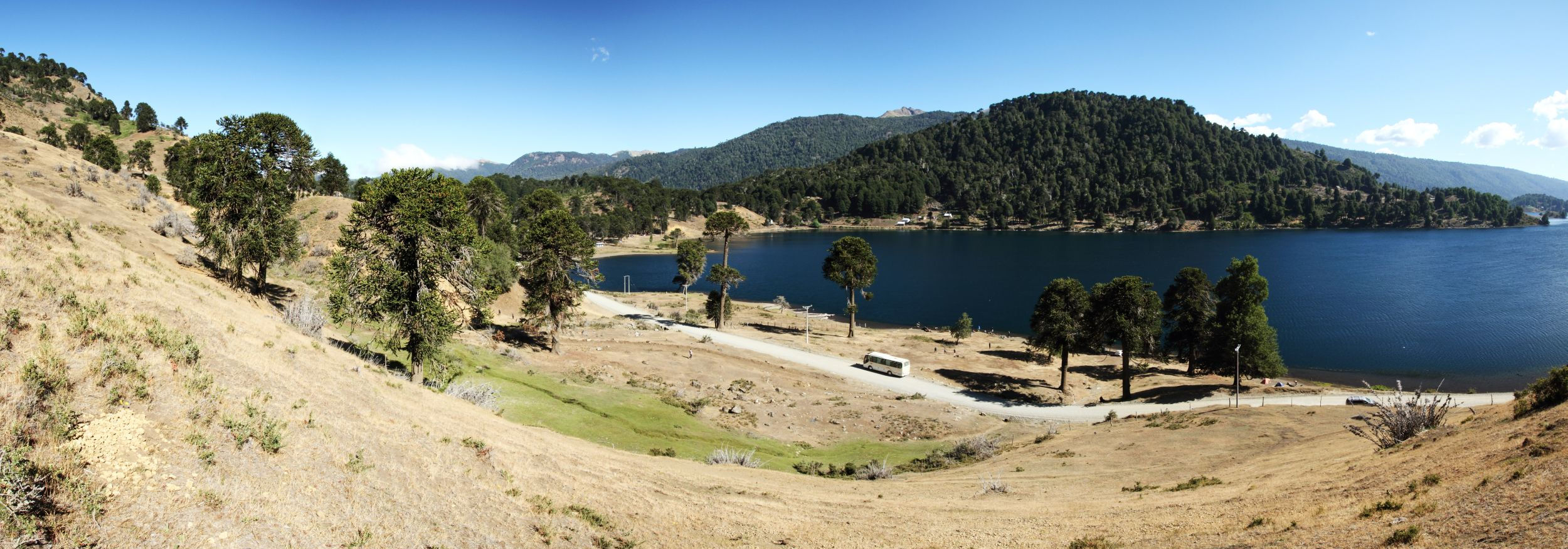
Those coming from Curacautín, have over- or underpassed the Cuesta las Raices, and continue their journey in direction to the border between Chile and Argentina, will note a marked change in the landscape: the southern beech forests are less dense, non-forested areas become more frequent not only directly at the valley floor but also on the slopes, and almost pure groves of monkey puzzle trees as well as park-like landscapes can bee seen: meadows with dispersed araucaria trees. The rain shade of the Andes with their high volcanoes becomes obvious here. However, average annual rainfall still exceeds 1000 mm in places, and the area around Lonquimay, Liucura, and Icalma is used for agriculture. This means that it is not always easy to clearly distinguish between natural and human influences on the ecosystems.
Click on the title image to see the landscape from another perspective.

East of the volcanoes


Click on the arrows or into the photo to change the view.
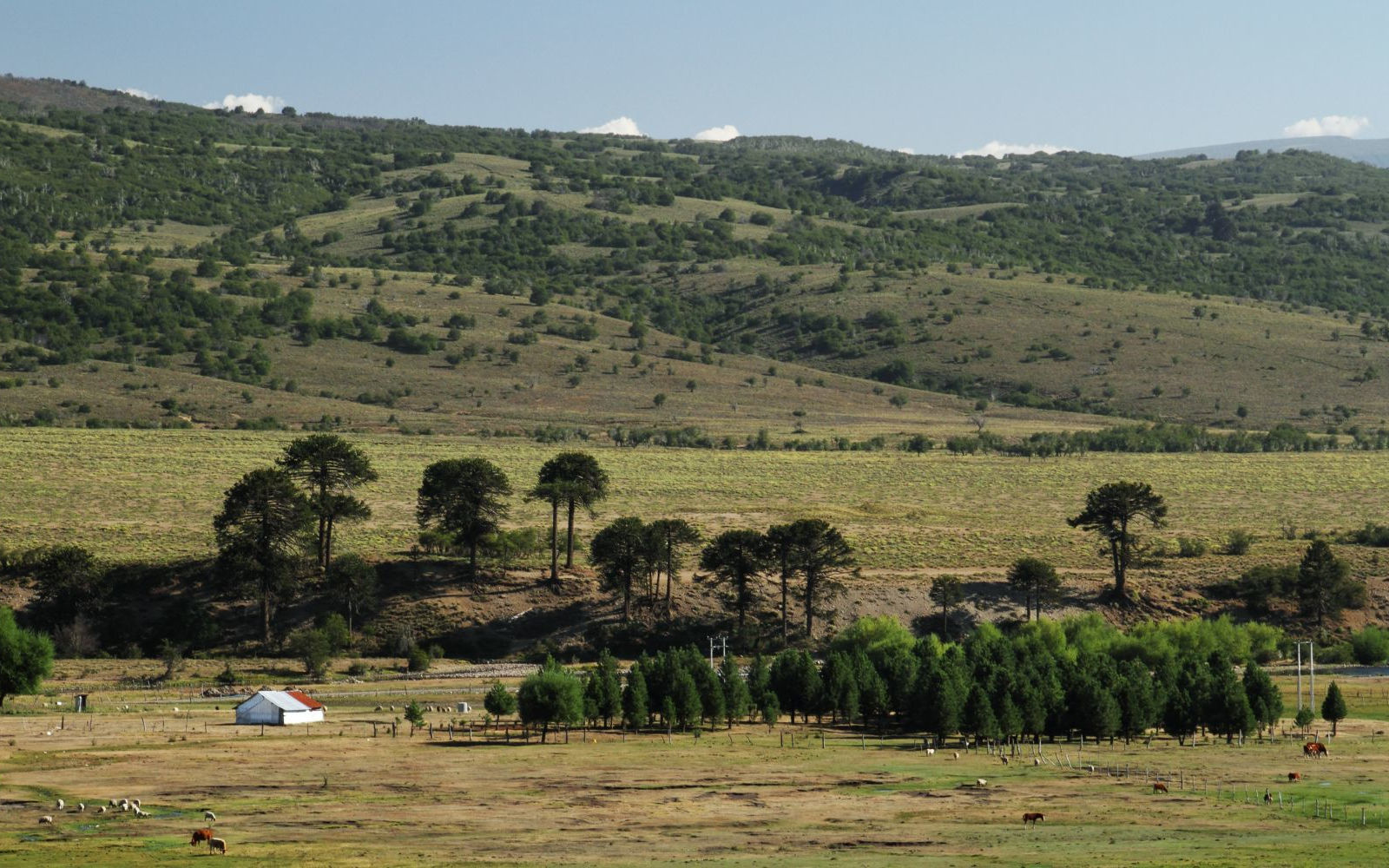
Characteristic landscape between Liucura and Icalma: whereas the valley floor is mainly used for livestock farming, the slopes are covered by partly open forests of deciduous southern beech trees and araucarias.

Wikipedia article on the Lago Icalma [Access source]
Spanish-language Wikipedia article on the Río Bío-Bío [Access source]