anden.at
Discover the Andes


Southern Patagonian Ice Field
by Martin Mergili


The Southern Patagonian Ice Field (Campo de Hielo Patagónico Sur) represents the third largest ice field in the world, after Antarctica and Greenland. The westerly winds prevailing at these latitudes are saturated with vapour after thousands of kilometres of travel across the Pacific Ocean. Air masses are forced to rise at the western slopes of the Southern Patagonian Andes. Vapour condensates, leading to plenty of precipitation. Due to the generally cool climate and the frequent cloud cover (low irradiation) the snow line elevation is low, so that the ice field can still persist. The outlet glaciers such as the Glaciar Perito Moreno, the Glaciar Viedma, the Glaciar Upsala, or the Glaciar Pio XI receive sufficient ice inflow to reach the lakes of the eastern forelands or the the Pacific Ocean.
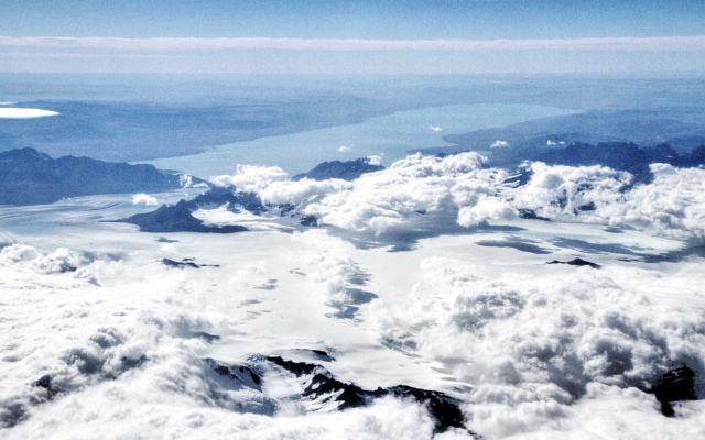
The Southern Patagonian Ice Field is very hard to access and can therefore be best observed from the air in the rare case of good weather. It is recommended to book an east-side window seat on regular flights between Puerto Montt and Punta Arenas.

The Southern Patagonian Ice Field from the air


Click on the arrows to view the Southern Patagonian Ice Field from different perspectives.
This aerial view shows the Southern Patagonian Ice Field on 28 February 2018. View in eastern direction to the Glaciar Viedma on the left side and the Glaciar Upsala on the right side. Lago Viedma appears in the background of the photograph.