anden.at
Discover the Andes


Salar de Atacama
by Selina Toplitsch


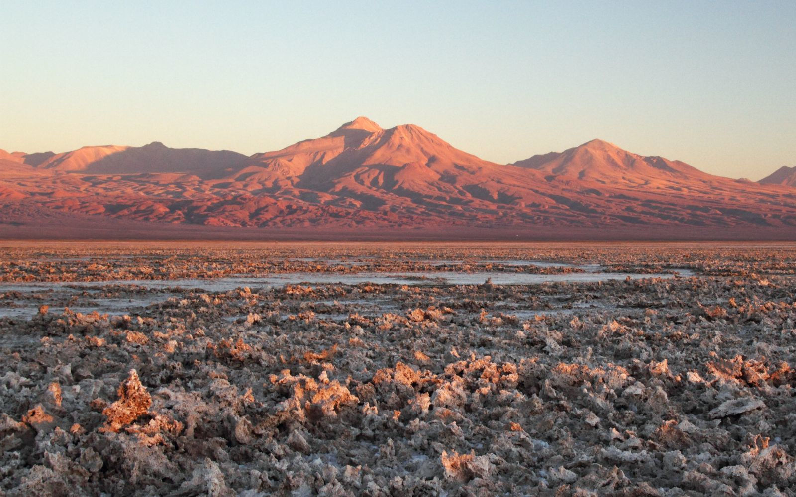
Salars (salt flats) are characteristic features of the Atacama Desert as well as of the Altiplano which is rather arid as well. The Salar de Atacama, with its area of approx. 3000 square kilometres, fills an endorheic basin west of the Altiplano. No continuous lake can form in this place due to the extreme aridity. Surface and subsurface inflow from the surrounding mountains allow some irrigated agriculture and the existence of settlements such as San Pedro de Atacama or Toconao near the margins of the salar. In total, the catchment area of the Salar de Atacama includes an area of approx. 15,000 square kilometres, where various types of salt are dissolved in flowing water, which are then transported into the salar and precipitate as the water evaporates. It is mainly the volcanic activity in the main range of the Andes which leads to the high diversity in minerals. The solids transported into the salar are deposited as well: the coarse and medium-grained material settles near the edge of the salar, whereas the fine material is transported all the way to the centre. This transition can be nicely seen when approaching one of the lagoons in the salar (such as Laguna Chaxa or Laguna Tebinquinche).

The Salar de Atacama: an endorheic basin
This 3D views allows you to observe the Salar the Atacama from different perspectives. Use the left mouse button for rotating the view, the mouse wheel for zooming, and the right mouse button for panning.
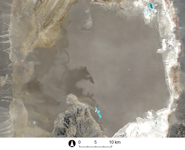
The Salar de Atacama fills a tectonic basin between the more than 4000 m high Cordillera Domeyko in the west and the main range of the Andes with its almost 6000 m high stratovolcanoes - such as the Licancabur - in the east. This landscape forms part of a large-scale system of tectonic horsts and grabens, oriented in north-south direction. It has developed through the subduction of the Nazca Plate beneath the South American Plate, and the related compressive processes. The Salar de Atacama is located at 2300 m asl. and has a maximum depth of 1700 m. The Cordillera de la Sal, up to approx. 200 m high, runs through the western portion of the Salar de Atacama.
Visit the contribution on the Cordillera de la Sal and learn more about the evolution of the entire salar!
This scene was generated with the QGIS plugin Qgis2threejs and uses the following libraries: three.js http://threejs.org/ (LICENSE) and Proj4js http://trac.osgeo.org/proj4js/ (LICENSE). Background: Stamen Terrain.

The Salar de Atacama in numbers
First, try to estimate the components of water input to the salar. Write your estimates in millions of cubic metres into the corresponding text boxes in the graphics and note that the order of magnitude of the average annual precipitation in the area of the salar is approx. 10 mm.
Show solution

Where does all the salt go to?
Each year, it is mainly the surface and subsurface inflows which bring approx. 300,000 tons of dissolved salt into the Salar de Atacama. The core of the salar consists of 90 per cent sodium chloride (NaCl). It precipitates through evaporation of the water.
Assume a density of 2 tons per cubic metre of salt and calculate:
- By how many millimetres does the surface of the salar rise each year?
- How old is the salar, if a constant salt input and an average depth of one kilometre is assumed?

mm/a
mill. a
What the surface can tell us


Click on the arrows or into the image to switch between views of the Salar de Atacama and the Salinas Grandes.
The Salinas Grandes del Noroeste are located in the border area between the provinces of Salta und Jujuy in Argentina - east of the main range of the Andes - in an endorheic basin of the Altiplano at approx. 3400 m asl. As it can be seen on the photographs, the surface structure of the Salinas Grandes differs quite much from the Salar de Atacama.
What could be the reason for this difference?