anden.at
Discover the Andes


Cordillera de la Sal
by Martin Mergili


anden.at
Discover the Andes
by Martin Mergili

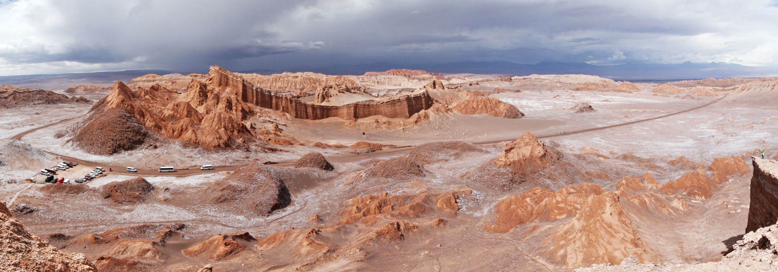
Travellers having crossed the Cordillera Domeyko when coming from Calama, and now expecting to arrive at San Pedro de Atacama very soon, will realize that this is not exactly true. There is anoher chain of hills in between which is, however, maximum 200 m high, stretching along the western margin of the Salar de Atacama. Rather unspectacular from the distance, a closer look reveals that the Cordillera de la Sal represents one of the geological, geomorphologic, and scenic highlights of Chile and maybe South America. A wild, but somehow structured mess of layers of various colours and shapes challenges the human eye. Various viewpoints do exist along the highway, at the Pucará de Quitor, and particularly in the Valle de la Luna, which is most impressive at sunset.
Click into the title image to see the Cordillera de la Sal from different perspectives.

Structure and evolution of the Cordillera de la Sal
Click on the arrows or into the image to switch between various views of the rocks building up the Cordillera de la Sal.
These photos show the geological features of the Cordillera de la Sal at various levels of detail, from broad overviews to details of particular rocks.
First, describe what you can see on the individual photographs. Then, try to identify the types of rock shown in detail, and to derive their evolution from their appearance. If you are unsure about the one or the other aspect, you are highly welcome to formulate two or more hypotheses.


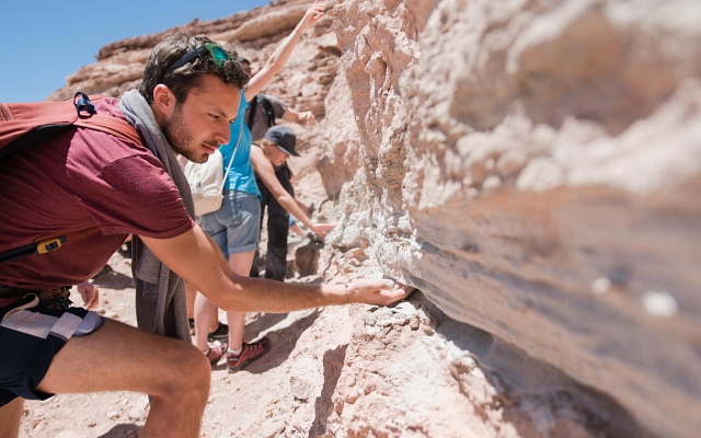
The photos 1-3 show a volcanic layer of partly consolidated pyroclastic material (also called tephra) which is bright in colour and therefore rich in silicium dioxide. These deposits are interspersed between lake and river sediments. It seems that the volcanic deposits are very fine-grained: most probably they represent volcanic ash consolidated to tuff. That ash was ejected during an explosive eruption of a stratovolcano.
Photo 4 shows halite (natrium chloride or NaCl). It forms when water evaporates and the dissolved salt precipitates. You are invited to learn more about halite and its use in the contribution on the Salineras de Maras in Peru.
The Photos 5-7 show tilted and folded layers of various sedimentary rocks. The red-coloured rocks represent consolidated deposits of ancient alluvial fans and lakes - sandstones, siltstones, and claystones. The brighter layers, in contrast, represent halite, anhydrite, and pyroclastic deposits. The dunes are built up of sand which was at least partly transported to this place from the Cordillera Domeyko.
But how did the tilted and folded sequences of the various rock layers evolve? Formulate one or more hypotheses and thereby tell the story of the entire Salar de Atacama.

Browse through the evolution of the Cordillera de la Sal by clicking on the arrows or into the graphics.
This graphics illustrates a hypothetic west-east profile through the continental crust in the area of today's Salar de Atacama at the beginning of the uplift of the Andes. The subduction of the Nazca Plate beneath the South American Plate led to compression, and further to the formation of faults and fault zones in the South American Plate. Some crust blocks were raised relative to others along these reverse faults.
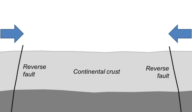
This model represents a distorted, schematic view out of scale which does not claim to be complete or correct. Instead, its purpose is to convey an impression of how the evolution of the Salar de Atacama and the Cordillera de la Sal could have happened.

A view into the core of the fold
Click on the arrow to start the time lapse video.
This time lapse video allows a view into the core of a geological fold. The central part consists of older layers, which became exposed as the overlying layers were raised and eroded. The margin was tilted, but raised only to a lesser extent, so that this area was eroded less deeply. Therefore, the age of the exposed rock layers increases from the margin to the centre. Another nice example of a geological fold is shown in the contribution on the Pucará de Quitor.
Time lapse video: Claudia Blauensteiner

Arriagada, C., Cobbold, P.R. & Roperch, P. (2006): Salar de Atacama basin: A record of compressional tectonics in the central Andes since the mid-Cretaceous. Tectonics 25(1), doi:10.1029/2004TC001770 [Access source]
Hartley, A.J., May, G., Chong, G., Turner, P., Kape, S.J. & Jolley, E.J. (2000): Development of a continental forearc: A Cenozoic example from the Central Andes, northern Chile. Geology 28(4): 331-334 [Access source]
Mpodozis, C., Arriagada, C., Basso, M., Roperch, P., Cobbold, P. & Reich, M. (2005): Late Mesozoic to Paleogene stratigraphy of the Salar de Atacama Basin, Antofagasta, Northern Chile: implications for the tectonic evolution of the Central Andes. Tectonophysics 399(1-4): 125-154 [Access source]
Muñoz, N., Charrier, R. & Radic, J.P. (2000): Formación de la Cordillera de la Sal por propagación de fallas y plegamiento por despegue, II Región, Chile. Congreso Geológico Chileno 9, Actas 2: 604-608
Wilkes, E. & Görler, K. (1988): Sedimentary and structural evolution of the Cordillera de la Sal, II Región, Chile. Congreso Geológico Chileno 1
German-language excursion report of the Freie Universität Berlin 2009 [Access source]
Excursion report of the Stanford University 2015 [Access source]