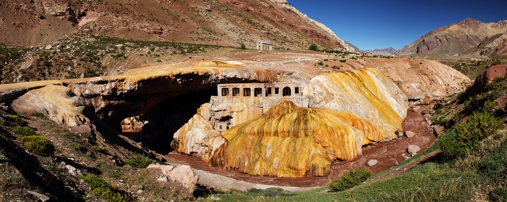

At Punta de Vacas, the National Road 7 sharply changes its direction and now follows in western direction the wide, trough-shaped valley of the Río Las Cuevas, a tributary of the Río Mendoza. Here, the landscape-shaping effects of the Pleistocenic glaciers become obvious at a first glance. After having passed the ski resort of Penitentes, the traveller arrives at a quite unconspicuous village named Puente del Inca, which is mainly characterized by some tourist infrastructure. It is highly recommended to take a short walk, passing the numerous mobile souvenir shops, down to the Río Las Cuevas: suddenly, one stands in front of a highly peculiar sculpture, shimmering in yellowish-whitish colours, which forms a natural bridge across the river.

Formation of the Puente del Inca
Formulate at least one hypothesis on how the Puente del Inca could have formed. Try to graphically illustrate the postulated sequence of processes.
Michael will now try to find possible explanations for the development of this extraordinary landform. Start the movie by clicking on the arrow. Some German language skills are required to understand Michael's explanations.
The formation of the Puente del Inca is not completely clear. Summarize the hypotheses formulated by Michael in your own words and try to graphically illustrate the process sequences. Does one of Michael's hypotheses correspond to your own assumption?
Movie: Peter Mathis and Gregor Offenthaler | Speaker: Michael Gerdenitsch

Wikipedia article on Puente del Inca [Access source]
Spanish-language info table on site


