anden.at
Discover the Andes


Cuesta de Miguez
by Martin Mergili


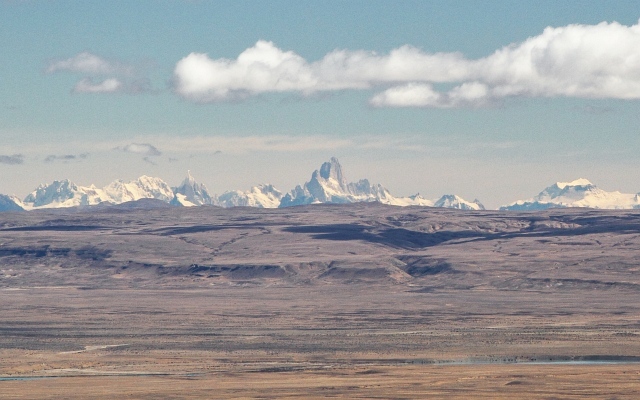
Those coming from La Esperanza or Torres del Paine and travelling on the legendary Ruta 40 in northwestern direction towards El Calafate or El Chaltén, might first be bored by the sparsely vegetated, uniform landscape of the Patagonian Tableland. Rocks date back to the Precambrian here, but have been reshaped by volcanism and various surface processes. The road climbs up slowly but surely, before the terrain suddenly drops from 800 m asl. to less than 200 m asl. in the valley of the Río Santa Cruz. This main river of southern Patagonia has eroded a deep valley into the tablelands, draining the lage Pleistocenic lakes towards the Atlantic Ocean. In case of fine weather - which is not rare in the rather arid eastern part of Patagonia - a great view opens up all the way to the Southern Patagonian Andes at a distance of more than 100 kilometres. A stop at the viewpoint offers a deep insight into the geomorphological features of this area.

Views from the Cuesta de Miguez


Click on the arrows to zoom into certain portions of the title image.
View in northwestern direction over a distance of 160 km all the way to the Southern Patagonian Andes with Cerro Torre (3128 m), Monte Fitz Roy (3405 m), and the active stratovolcano Lautaro (3623 m) in the right background, rising approx. 2000 m above the Southern Patagonian Ice Field.