anden.at
Discover the Andes


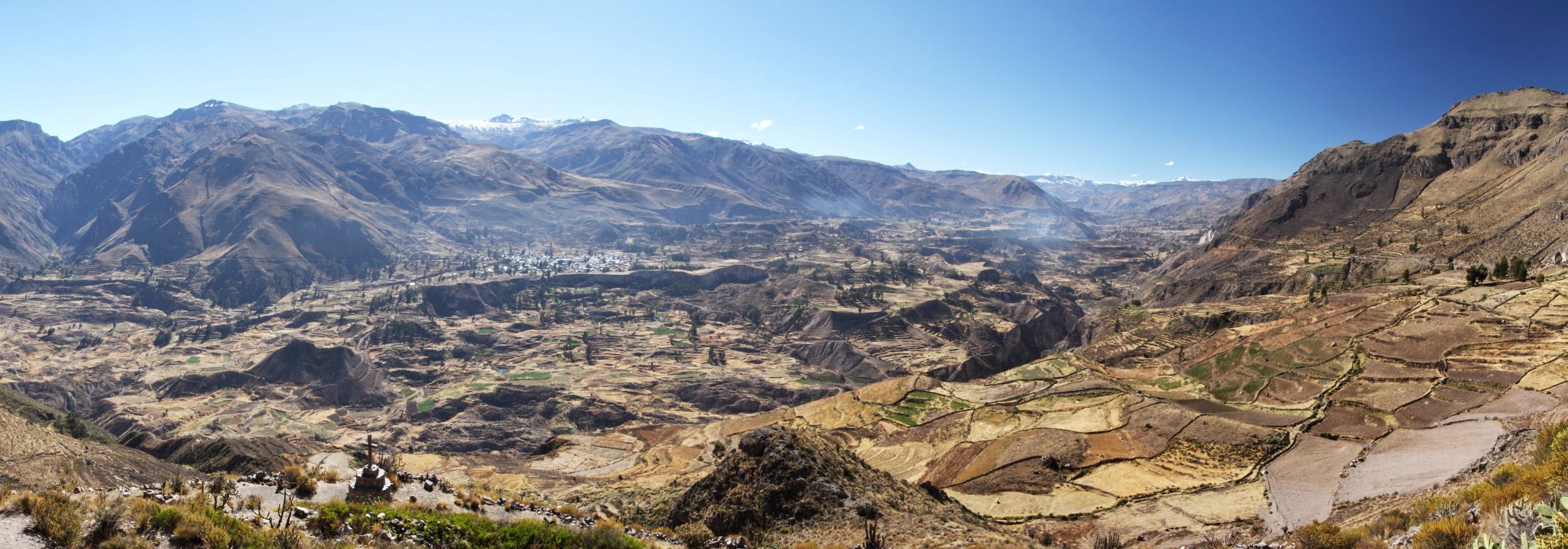
Cañón del Colca
by Caroline Lasser


anden.at
Discover the Andes
by Caroline Lasser

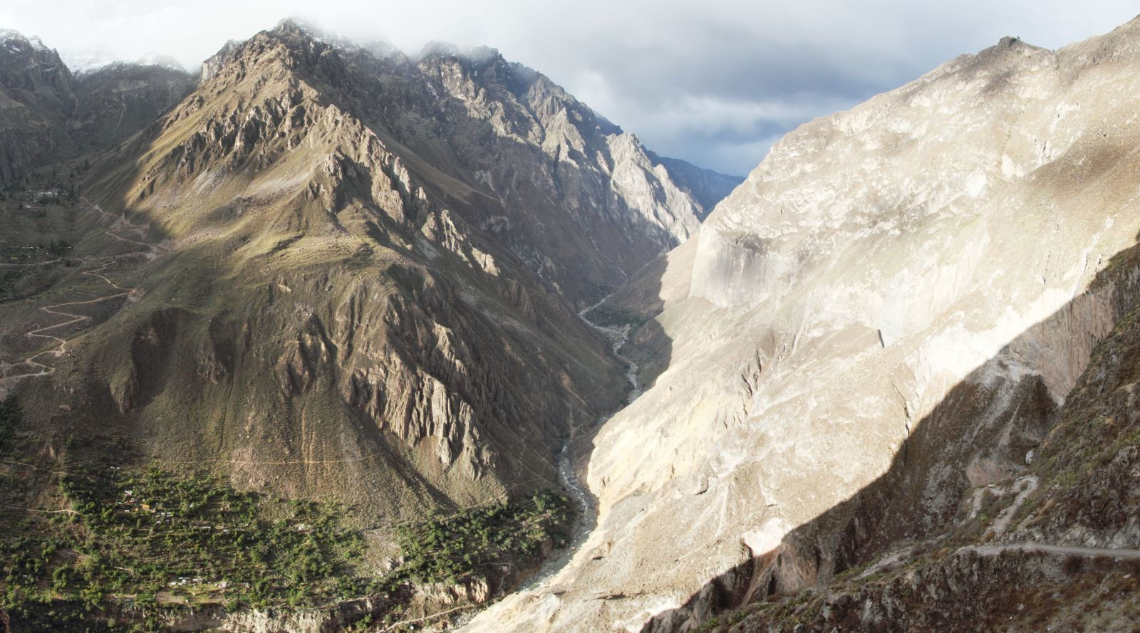
The Colca Canyon - named after the Río Colca flowing at its bottom - represents one of several very deep canyons draining the southern Peruvian Andes towards the Pacific Ocean. Even though it is hard to define the depth of a canyon - and even what is a canyon at all - the Colca Canyon is often considered one of the deepest canyons in the world. It generally follows an east-west direction, characterized by a wide valley with a narrow gorge at the bottom in its eastern (upper) part - also known as Valle del Colca - and a deep, generally V-shaped canyon in its western (lower) part. All this is the result of a complex interplay of various geological and geomorphologic processes, some of which are related to the location of the canyon in the Andean Central Volcanic Zone.
You can descend down to the deepest part of the canyon by clicking in the title image.

Geological evolution of the Colca Canyon


The Colca Canyon can tell us a lot about its geological past - but it only does if the right questions are asked. Thousands of vertical metres of canyon walls give evidence of the changeable history of uplift, incision, and deposition.
Try to tell the history of the Colca Canyon. The photographs in this contribution (you can change the view by clicking on the arrows or in the image) and the transect through the Peruvian Andes can support you. You can also postulate two or more hypotheses.
You can travel through the history of the Colca Canyon by clicking on the arrows.
Imagine a rather flat landscape profile with a shallow river valley. This could have been the situation before the main uplift of the southern Peruvian Andes which started approx. 13 million years (Ma) ago.


Active geomorphology in the Colca Canyon
The Colca Canyon is still highly active from a geological and gomorphologic point of view. This can be a challenge for the residents and for local authorities.
Look at the picture! Can you find the landslide?
Show solution


Lacroix, P., Berthier, E., & Maquerhua, E. T. (2015). Earthquake-driven acceleration of slow-moving landslides in the Colca valley, Peru, detected from Pléiades images. Remote Sensing of Environment 165: 148-158 [Access source]
Mariño, J., & Macedo, L. (2012). Mapa geológico a escala 1/25,000 del valle del Colca (Arequipa): herramienta para la gestión de riesgos y la planificación del turismo. SlideShare [Access source]
Thouret, J. C., Wörner, G., Gunnell, Y., Singer, B., Zhang, X., & Souriot, T. (2007). Geochronologic and stratigraphic constraints on canyon incision and Miocene uplift of the Central Andes in Peru. Earth and Planetary Science Letters 263(3-4): 151-166 [Access source]
Thouret, J. C., Gunnell, Y., Jicha, B. R., Paquette, J. L., & Braucher, R. (2017). Canyon incision chronology based on ignimbrite stratigraphy and cut-and-fill sediment sequences in SW Peru documents intermittent uplift of the western Central Andes. Geomorphology 298: 1-19 [Access source]
Vasquez Cardeña, S., Peña, F., Sulca, P., Farfán, J., Carpio, J., & Moreno, J. (2012). Características hidrogeológicas del valle del Colca, entre Chivay y Maca [Access source]

Movie The Andes give, the Andes take with sequence on the Cañón del Colca [Access movie]
This contribution was modified and extended by Martin Mergili.